Eta Now a Tropical Storm – Still Could Cause Problems in the Gulf
Back in the day it sure seemed as if tropical cyclones knew how to behave. They would form, strengthen, make landfall, and then dissipate. But this is the historic hurricane season of the year 2020 so you know the tropical systems are just not going to cooperate with what history says should be true.
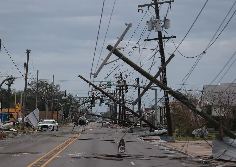
For example, yesterday morning at this time we were telling you about the then category 4 Hurricane Eta. That system did make landfall in Nicaragua and yes, the damage is devastating. Eta has since weakened to a tropical storm. Forecasters say the system will remain over land until Friday and should continue to weaken during that time.
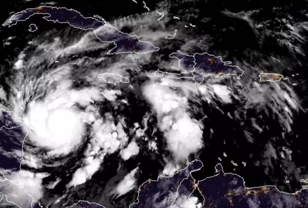
However, tropical model guidance suggests that there will still be a center of circulation left with the system when it reappears over the warm waters of the western Caribbean just off the coast of Belize. At that time, Eta is forecast to restrengthen into a tropical storm and then turn northward.
As of now, the official track forecast from the National Hurricane Center will bring Eta, as a tropical storm across Cuba and very near Key West Florida by early next week. However, some of the model guidance suggests that Eta could not interact with the west coast of Florida directly and stay over the waters of the eastern Gulf of Mexico for several days.
Should that scenario unfold we could be looking at another tropical cyclone in the Gulf of Mexico spinning and strengthening and possibly threatening yet another landfall later in the week. This is truly going to have to be a "watch and wait" system because there are a lot of things that could happen.
First, the system could actually fall apart over Central America before Friday. The storm might not restrengthen if it does push back out over the open waters of the Caribbean. The system could be pushed onshore in South Florida which should weaken it further. Or, the system could behave as described above a continue our hurricane anxiety for at least another week or so.
Popular Louisiana Attractions
More From My Magic LC 92.1 FM